The Immersive Atlas of Wine
Interactive GIS maps, 3D terrain analysis, and reference-grade content spanning the world’s most important wine regions. The only platform where you can search an appellation, fly to its vineyards, and read the soil, climate, and classification for every one.
What’s Inside
A complete set of interactive GIS tools, each built with reference-grade content for every mapped region. Globe, Fast Maps, 3D terrain, custom Map Makers, immersive Tours, and professional beverage calculators.
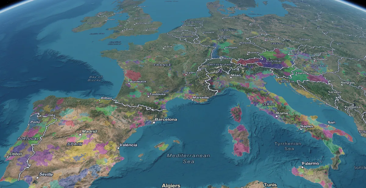
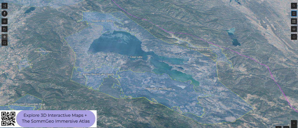
One Globe. The Whole Wine World.
Search an appellation, fly to its terrain, read its story. A single immersive 3D atlas with reference-grade detail for every mapped region. The only searchable globe of the wine world.
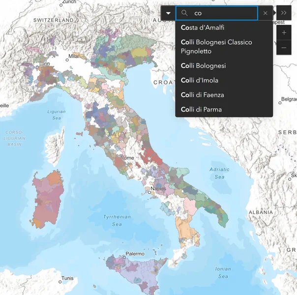
Every Appellation. Searchable.
The professional’s quick reference. Search any appellation, filter by classification, read the data. Built for the speed of real questions, on any device.
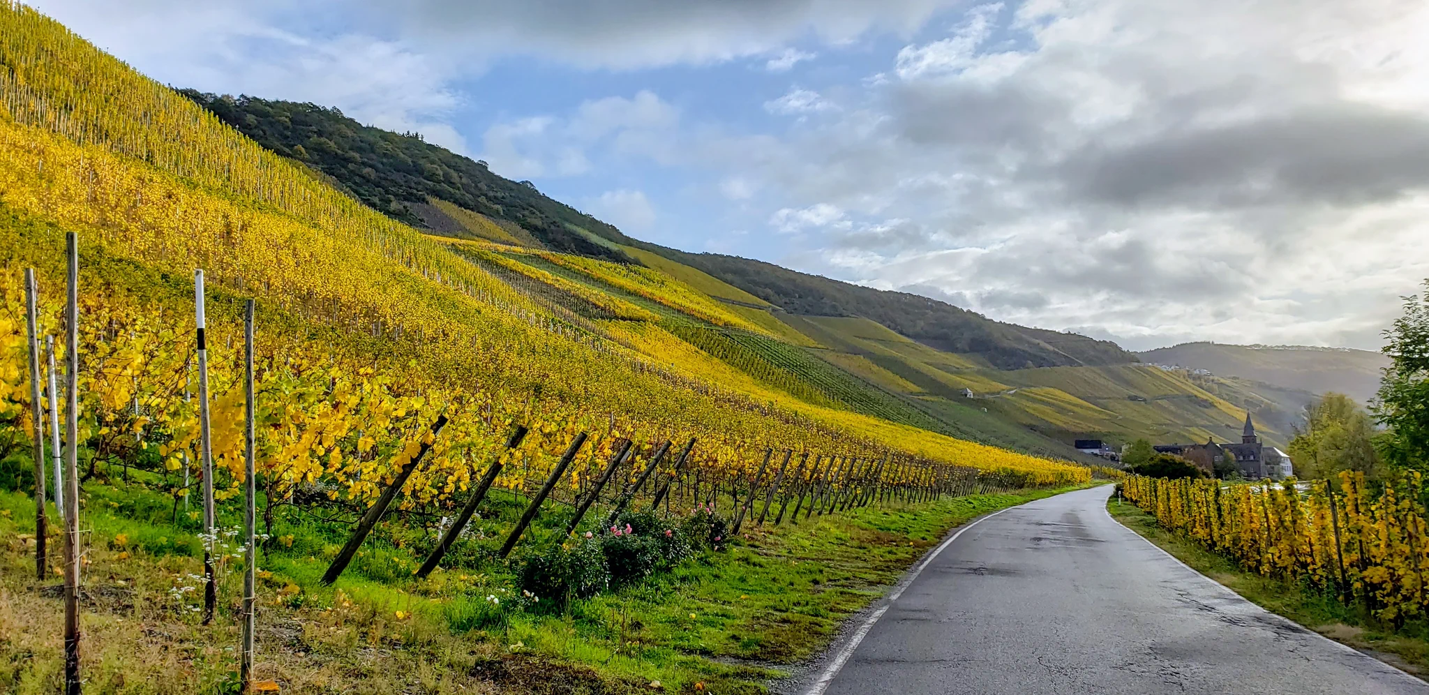
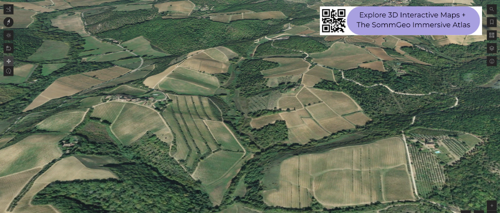
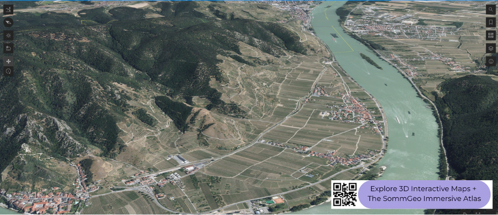
Terrain That Tells the Story
Elevation, aspect, slope rendered in 3D. Sun-aspect shading shows you what the vine sees.
Build the Exact Map You Need
Select regions, toggle layers, isolate the data that matters. A first-of-its-kind tool for visual wine study and presentation. Nothing comparable exists anywhere.

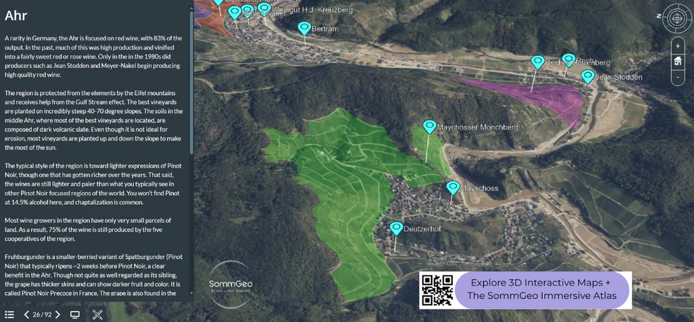
Fly Through the Vineyards
Immersive 3D presentations with geology, climate, classification, and producer data for every region covered. Built to the depth that the highest certifications demand. The next best thing to being there.
The Math Your Program Needs
Pour cost, pricing tiers, flight profitability, conversions. Calculated in seconds, not spreadsheets.
Today’s Complimentary Content
Every day, a different piece of premium content opens to the public. No signup required. Explore it while it’s open.
Complimentary Reference Maps
High-resolution wine maps available for free download. Each one built with the same cartographic precision as the full SommGeo atlas.
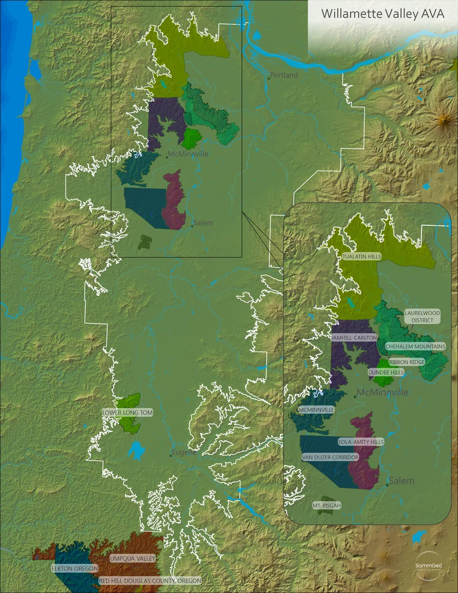
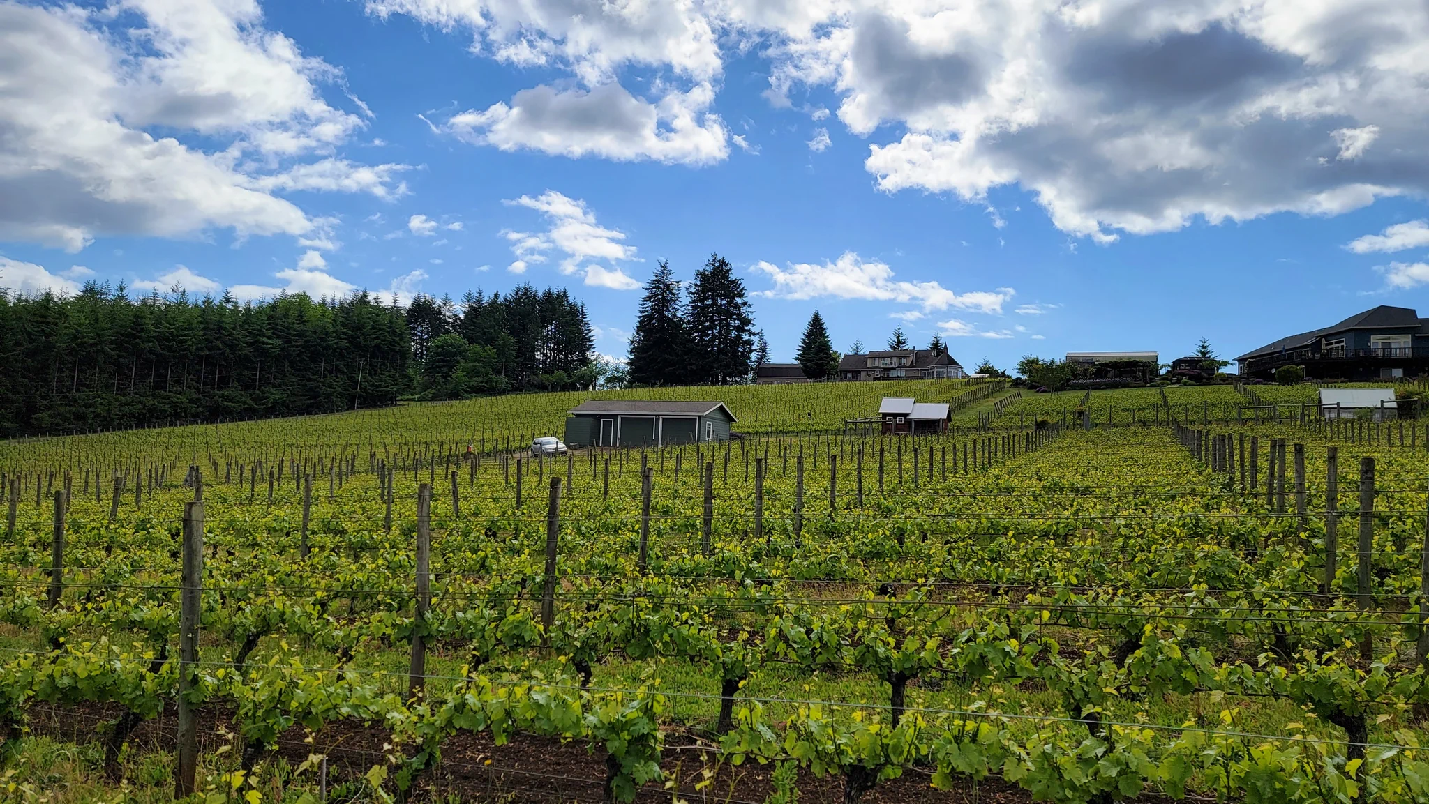
Willamette Valley
Oregon’s premier Pinot Noir territory mapped in high resolution with all AVA boundaries and sub-appellations.
Download Map
Oregon
From the Willamette Valley to the Rogue, Umpqua, and Columbia Gorge. Every Oregon AVA on one map.
Download Map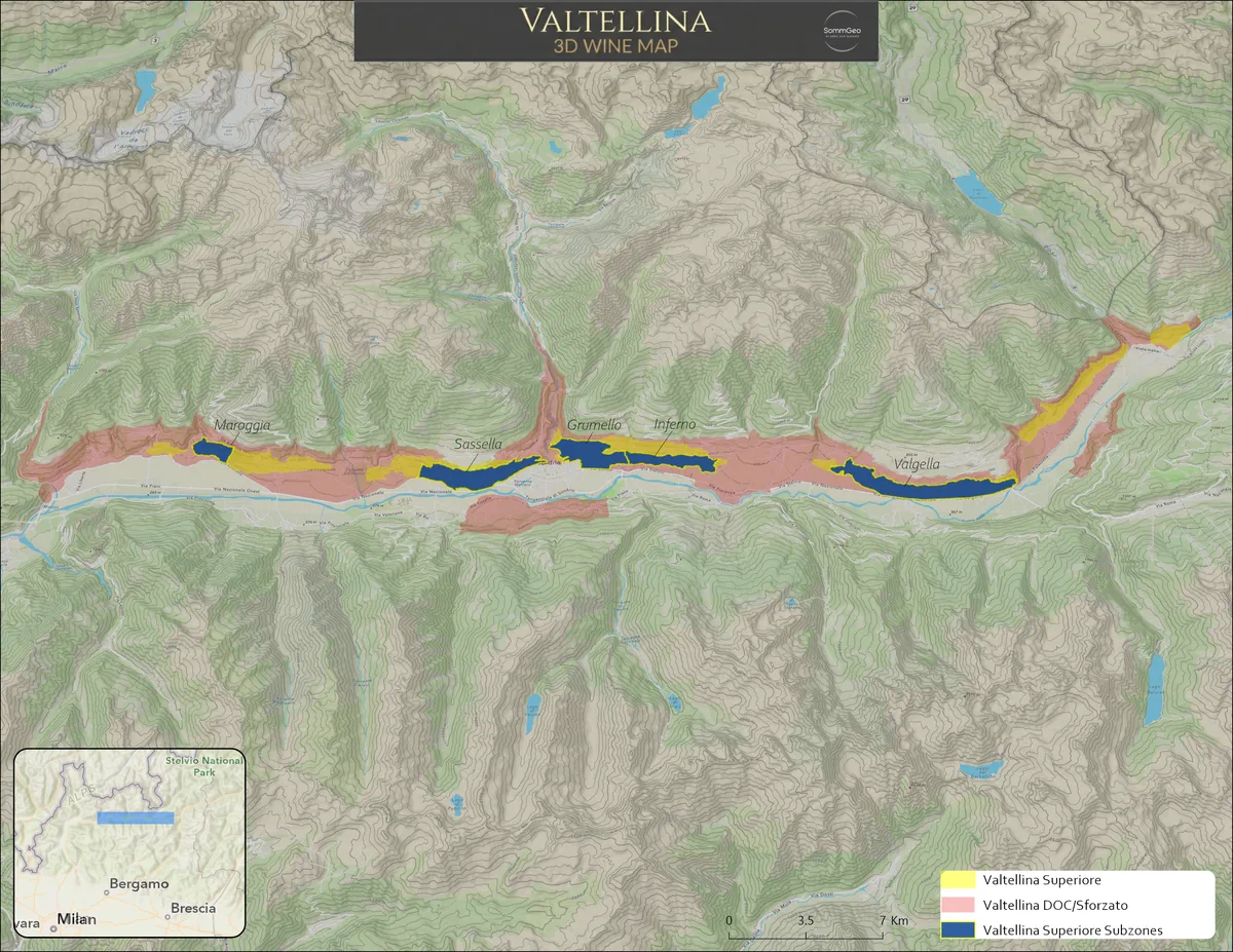
Valtellina
Alpine Nebbiolo on terraced slopes above the Adda River. Sforzato, Sassella, Grumello, Inferno, and Valgella.
Download Map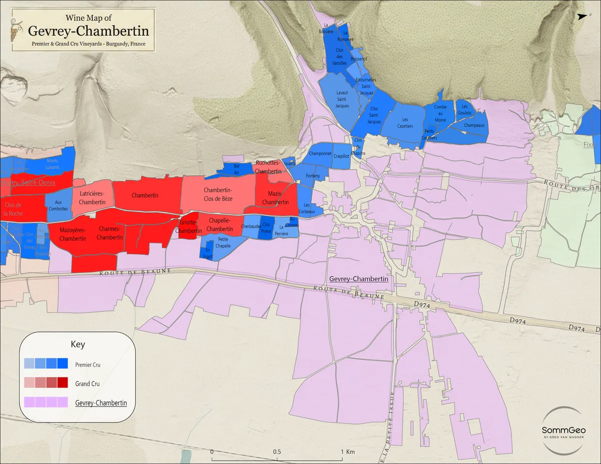
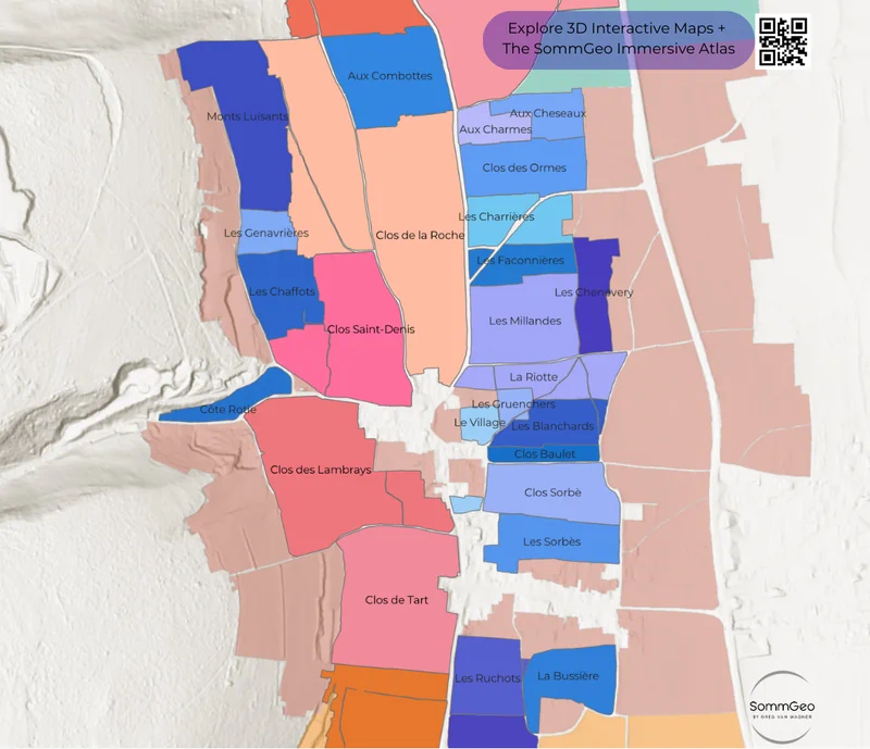
Gevrey-Chambertin
Grand Cru and Premier Cru climats of Gevrey-Chambertin, vineyard by vineyard.
Download Map
Galicia
Albariño’s Atlantic home, from Rías Baixas to the terraced canyons of Ribeira Sacra and Valdeorras.
Download Map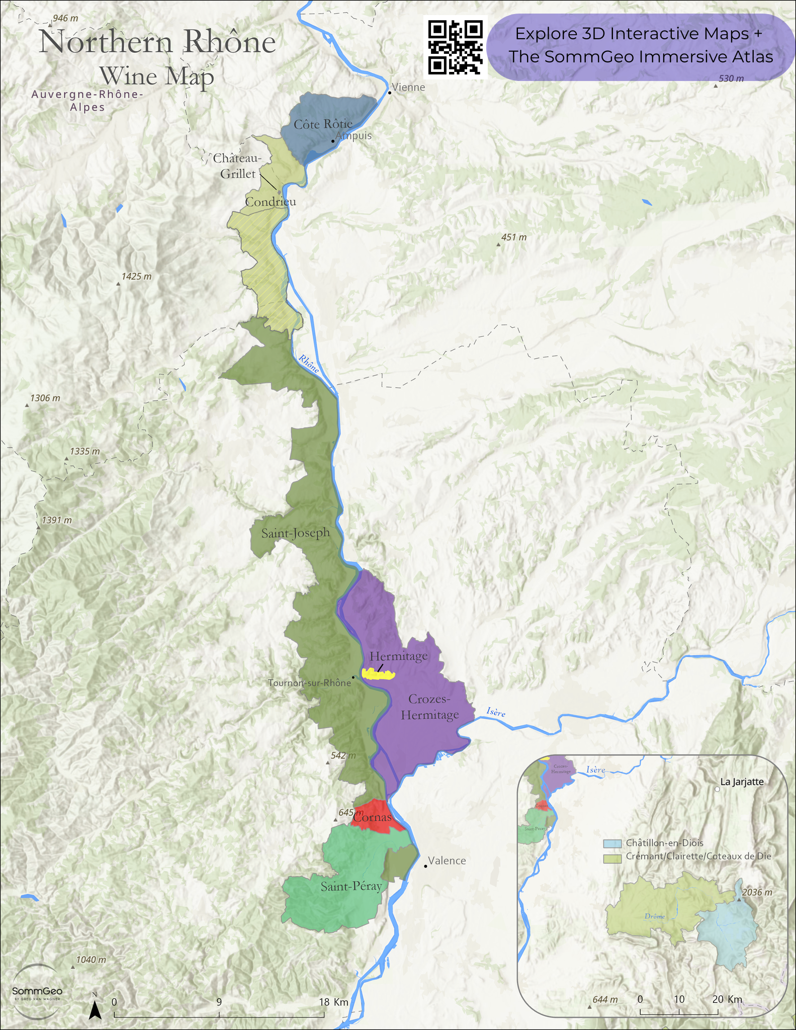
Northern Rhône
Côte-Rôtie south to the Diois appellations, following the Rhône and its Drôme tributary east. Every appellation mapped with vineyard detail.
Download MapBuilt for the Way You Work
Whether you’re behind the bar, in front of an exam board, building a list, or teaching the next class.
Working Sommeliers
The reference you reach for on the floor, not just at the study table. Fast answers to real questions.
Certification Candidates
Content at the level where CMS, WSET, and MW candidates study. Visual tools that make geography stick.
Beverage Directors
Pricing tools, costing calculators, and regional data built for the pace of an actual beverage program.
Educators
Map Makers and Tours that turn a lesson plan into an immersive experience. Show the terroir, not just a slide.
Explore by Region
15 countries. 110+ interactive pages. Fast Maps, 3D terrain analysis, custom Map Makers, and immersive Tours for every region.
France
Fast Maps · 3D · Map Maker · Tours
Italy
Fast Map · 3D · Map Maker · Tours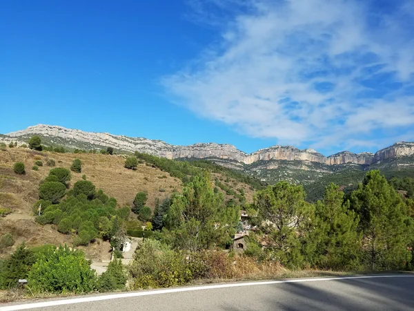
Spain
Fast Map · 3D · Map Maker · Tour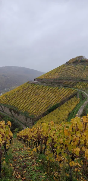
Germany
Fast Map · 3D · Map Maker · Tour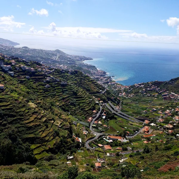
Portugal
Fast Map · 3D · Map Maker · Tour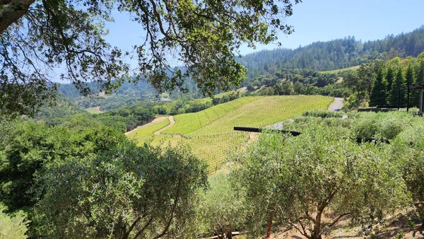
United States
Fast Map · 3D · Map Maker · Tours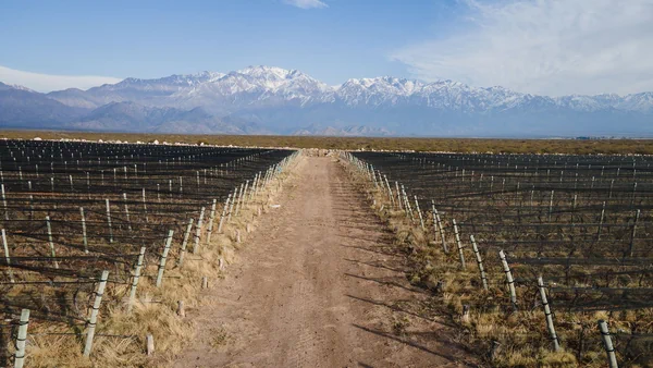
Argentina
Fast Map · 3D · Map Maker · Tour
Australia
Fast Map · 3D · Map Maker · Tour
Austria
Fast Map · 3D · Map Maker · Tour
Chile
Fast Map · 3D · Map Maker · Tour
New Zealand
Fast Map · 3D · Map Maker · Tour
Greece
Fast Map · 3D · Map Maker · Tour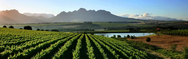
South Africa
Fast Map · 3D · Map Maker · Tour
Central & Eastern Europe
Fast Map · Map MakerSee Everything
Browse the full atlas
What Industry Leaders Say
“SommGeo is where Google Earth meets the Master Sommelier Exam; this unique platform is not only the next best thing to visiting wine country in person, but a complement to prepare for and recall such visits.”
“SommGeo proved to be a valuable and engaging tool for our planned content. I would highly recommend SommGeo to anyone seeking a modern approach to wine discovery and education.”
Trusted by 200+ Wine Organizations Worldwide
Kaiken

Antigal
Chalone
Keermont
Calera
Merry Edwards
WillaKenzie
Jermann
Medici Ermete
PRCC
Wente Vineyards

As One Cru
Pio Cesare

Bisol
Esparao

DonnHoff

JJ. Christofel Erben
Sartori
Ventisquero
Volio Imports
Beaujolais
Roederer Estate
Saint Supery
Banfi

Marques de Murrieta
Dr. Loosen

Symington Family Estates
Your Region’s Story Is Geographic. We Build the Platform to Tell It.
Custom 3D mapping platforms for producer associations, importers, distributors, and wineries. Show importers the place, not just the wine. Replace a PDF with an interactive experience your trade partners will actually use.
See What We Build
110+ Pages of Wine Geography. Start Anywhere.
Maps, tours, terrain analysis, and professional tools. Try any complimentary demo, then see the full atlas.